X
Request
When?
-
Where?
What?
continue
search & book Quick request
Pustertal valley cycling path

Pustertal Valley Bike Route: Innichen - Bruneck

Road bike, E-Bike & Pleasure Cycling

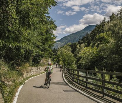
The Pustertal cycle path from Innichen to Bruneck takes you through varied landscapes, past meadows, forests and lakes. The route runs away from traffic and is ideal if you want to enjoy nature in peace and relax.


Directions

The starting point is in the centre of Innichen, near the railway station and the East car park. From there, cycle westwards. Just before the access road to the SS49, join the cycle path leading directly to Neutoblach at 1,210 metres. Continue through wide meadows and fields towards Niederdorf. Shortly before the campsite, pass beneath the main road and the railway line. At the end of Niederdorf, at 1,154 metres, the route passes beneath the railway line again.

The route then continues partly along quiet side roads and partly on a separate cycle path to Welsberg at 1,087 metres and towards the Olang reservoir. A gravel path follows the railway line and the lakeshore through the woodland. After the lake, the gravel path becomes a narrow paved road leading to Oberolang at 1,080 metres. From there, continue to Mitterolang at 1,048 metres and Niederolang at 1,024 metres. The route then leads towards Unterwielenbach and Percha. Away from traffic and noise, the cycle path runs through dense forests and several tunnels until you reach Bruneck at 835 metres.


Author's tip

Possible variations along the route:

Valle di Casies-Gsieser Tal Bike Route from Monguelfo to Santa Maddalena-St. Magdalena – 15 km (9.5 miles)
Experience the rural lifestyle.
Valle Anterselva-Antholzertal Bike Route from Rasun-Rasen to Anterselva di Mezzo-Antholz Mittertal – 13.5 km (8.5 miles)
On the route to one of the most beautiful high mountain lakes in South Tyrol-Südtirol.
Val Badia Bike Route from Brunico to San Vigilio or to San Martin – 23 or 24 km (14.5 or 15 miles)
Getting to know the Ladin culture and language.
Valli di Tures and Aurina-Tauferer Ahrntal Bike Route from Brunico to S. Giacomo-St. Jakob – 36 km (22 miles)
On two wheels through the realm of more than seventy peaks of three thousand meters (ten thousand feet).

Tour map & altitude profile
Our quality promise The certified quality of the BikeHotelss Südtirol